For more information on Agricultural Best Management Practices:
NRCS Field Office Technical Guide (Section IV, Conservation Practices)
Agricultural BMP Handbook for Minnesota, 2nd Edition
NRCS Field Office Technical Guide (Section IV, Conservation Practices)
Agricultural BMP Handbook for Minnesota, 2nd Edition
Water and sediment control basins
|
From the Agricultural BMP Handbook for Minnesota, 2nd Edition:
A water and sediment control basin (WASCOB) is a small earthen ridge-and-channel or embankment built across (perpendicular to) a small watercourse or area of concentrated flow within a field. They are commonly built in a parallel series with the first ridge crossing the top of the watercourse and the last ridge crossing the bottom, or nearly so. They are designed to trap agricultural runoff water and sediment as it flows down the watercourse; this keeps the watercourse from becoming a field gully and reduces the amount of runoff and sediment leaving the field. WASCOBs are similar to terraces in form and function, but the two practices are not interchangeable. Whereas terraces (and other contour practices, such as contour stripcropping and contour buffer strips) work best on relatively uniform slopes, WASCOBs are generally reserved for fields with irregular topography where contour practices would be difficult to implement or likely to fail. While terraces generally extend all the way to field edges, following the contour of a slope in a ribbon-like pattern, WASCOBs from a distance look more like short, straight slivers, just long enough to bridge an area of concentrated flow. WASCOBs are generally grassed, but some can be farmed. The runoff water detained in a WASCOB is released slowly, usually via infiltration or a pipe outlet and tile line. Why install WASCOBs on your land?
Similar & related practices
More information Guidance from USDA's Natural Resources Conservation Service (NRCS) Other resources |
Before WASCOB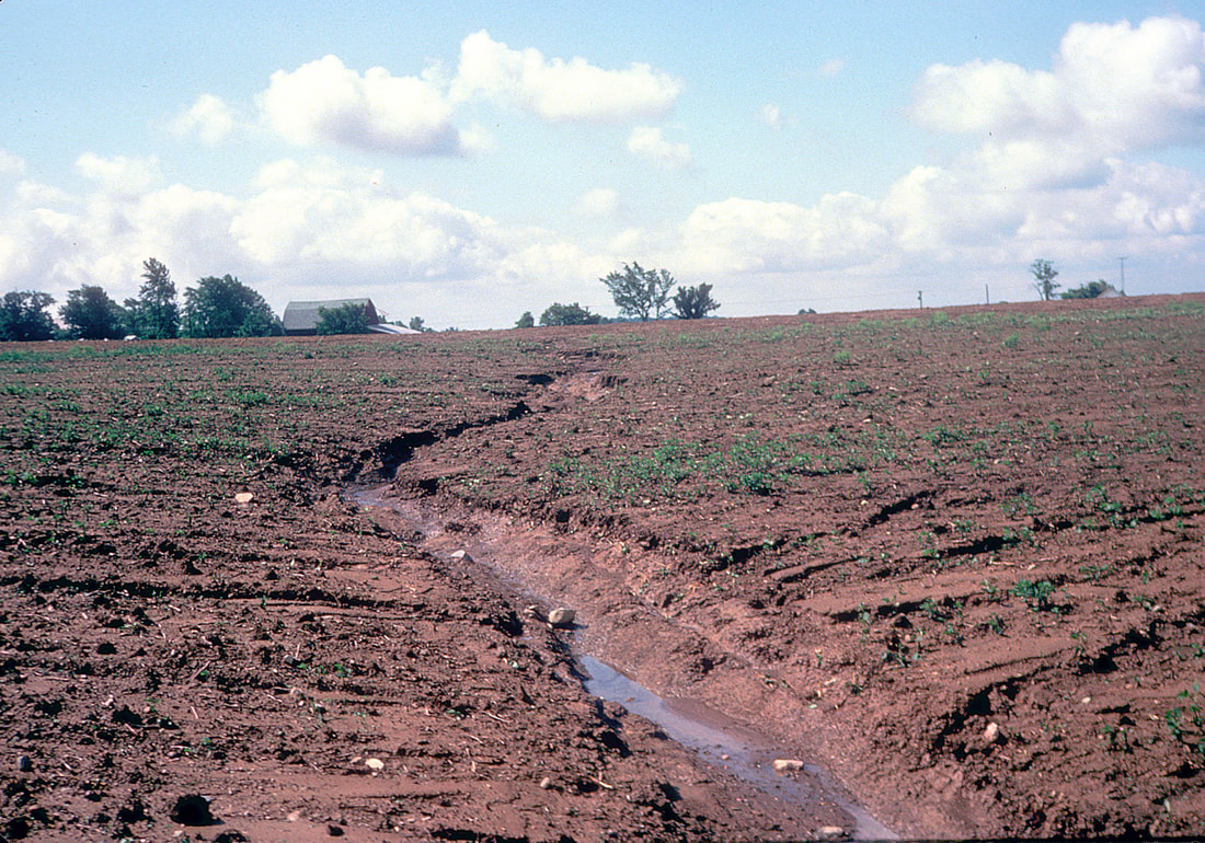
After WASCOB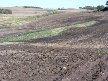
|
grassed waterways
|
From the Agricultural BMP Handbook for Minnesota, 2nd Edition:
Grass waterways are a type of conservation buffer; they are downhill grassed channels, generally broad and shallow, designed to prevent soil erosion while draining runoff water from adjacent cropland. As water travels down the waterway, the grass vegetation prevents erosion that would otherwise result from concentrated flows. Grass waterways also help prevent gully erosion in areas of concentrated flow. Similar & related practices Grass waterways are often used to drain water from areas of concentrated flow around constructed conservation practices such as terraces and runoff water diversions. Grass waterways work best when erosion is controlled on the contributing upland drainage area; otherwise the waterway will become filled with sediment and cease to function properly. In addition to terraces and diversions (mentioned above), examples of upland erosion control practices include contour stripcropping, contour farming, water & sediment control basins, conservation tillage, conservation crop rotation and cover crops. Gully/grade stabilization structures are often installed at grass waterway outlets to prevent gullies from forming there and progressing up the waterway. Grass waterways often adjoin other in-field or edge-of-field conservation buffers such as contour buffer strips, grass filter strips and field borders. Grass waterways of course involve grass planting and ongoing grassland management. More information Guidance from USDA's Natural Resources Conservation Service Other resources |
Before Grassed Waterway
After Grassed Waterway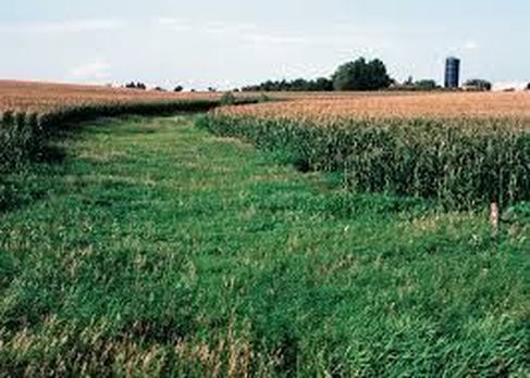
|
SIDE INLETS AND Grade Stabilization Structures
|
From the Minnesota Public Drainage Manual on Side Inlets:
Side inlet controls are used to convey water from a field into a drainage ditch and are one specific type of grade stabilization structure. In many open ditched systems, spoil banks are created from side-cast material during ditch construction. In many cases, where natural ground topography slopes toward the ditch, the spoil bank forms a berm, which will impound water on a temporary basis until it can be metered through a side inlet control (typically these have been culverts). Like other grade control structures, side inlets are used to prevent the formation of gullies or stop the advancement of gullies. Grade control structures improve water quality by reducing erosion and sediment bound pollutants. From the USDA NRCS on Grade Stabilization Structures: DEFINITION: A grade stabilization structure is used to control the grade and head cutting in natural or artificial channels. PRACTICE INFORMATION: Grade stabilization structures are installed to stabilize the channel grade and control erosion to prevent the formation or advance of gullies and headcuts. The practice is used in areas where structures are necessary to stabilize the site. Grade stabilization structures are not designed to regulate flow or water levels in a channel area. Special attention is given to enhancing fish and wildlife habitat where enhancement is practical. The practice is also helpful in reducing pollution from sedimentation. Grade stabilization structures are located so that the elevation of the inlet of the spillway is set at an elevation that will control upstream headcutting. A wide range of alternative types of structures are available for this practice and an intensive site investigation is required to plan and design an appropriate grade stabilization structure for a specific site. Additional information including design criteria and specifications are in the local NRCS Field Office Technical Guide. |
Before Side Inlet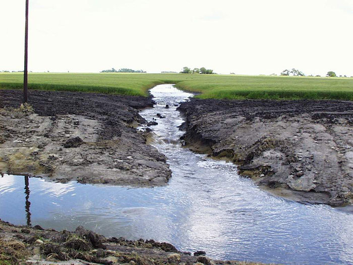
After Side Inlet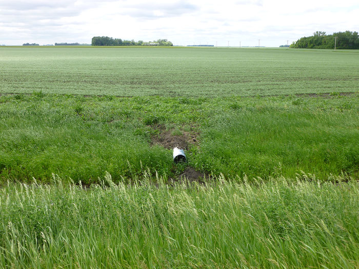
|
terrace
|
From the Agricultural BMP Handbook for Minnesota, 2nd Edition:
A terrace is an earthen embankment, ridge or ridge-and-channel built across a slope (on the contour) to intercept runoff water and reduce soil erosion. Terraces are usually built in a series parallel to one another, with each terrace collecting excess water from the area above. Terraces can be designed to channel excess water into grass waterways or direct it underground to drainage tile and a stable outlet. There are three main types of terraces. Broad-based terraces are designed to be entirely farmed; they are generally suitable for long, uniform gentle slopes of up to 6% or so. Grassed back-slope terraces are designed to be farmed on the front slope of the ridge but the back slope is graded to a steep pitch and grassed; they are generally suitable on slopes up to 15%. Narrow-based terraces, are where the entire ridge is grassed instead of just the back slope, and both sides of the ridge are steeply pitched; the narrow ridges require only a small part of the field to be removed from production. Why install terraces on your land?
Similar & related practices
More information Guidance from USDA's Natural Resources Conservation Service (NRCS) and other resources
|
Cropland with Terraces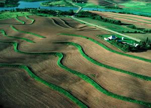
Planting on Terraced Land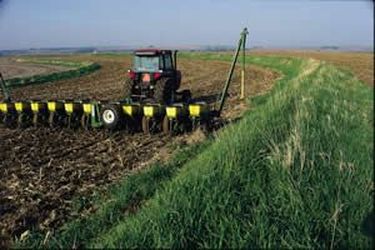
|
alternative tile intakes
|
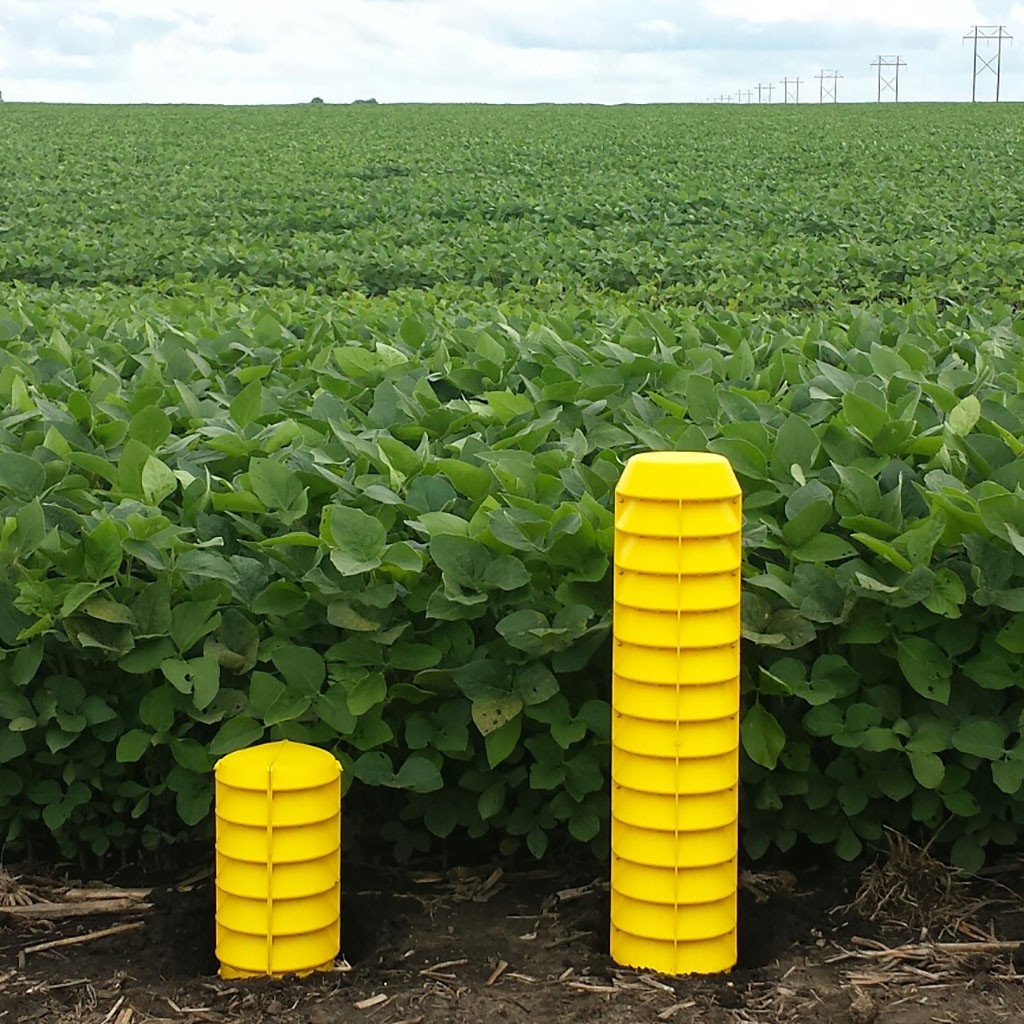
From the Agricultural BMP Handbook for Minnesota, 2nd Edition:
Definition and Introduction Isolated surface depressions in agricultural fields are commonly drained with subsurface tile that have surface intakes that outlet to underground drainage pipe systems. Open intakes that are flush with the surface of the ground can provide a direct conduit for sediment and nutrients to enter the tile system, which lead to ditches, streams, and rivers. Alternative tile intakes increase sediment trapping efficiency through increased settling time and/or filtering. They can also reduce the velocity of flow into the tile inlet. Alternative tile Intakes include:
Water Quality Effects Water quality benefits of alternative tile intakes are primarily associated with the temporary ponding of water and settling of particles before reaching a waterbody. The removal efficiency by this process is highly dependent on the size distribution of the influent sediment. Although a body of research on alternative tile intakes has been amassed in Minnesota, the vast majority is conducted in laboratories or simulations (Table 1). There is a wide range of reported performance:
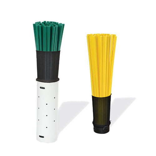
Key Design/Implementation Considerations Perforated Risers Perforated risers must be farmed around. The minimum diameter should be five inches. Holes in the risers should be large enough to allow more than double the design flow in order to prevent plugging (USDA NRCS, 2016). Gravel Inlets Rock and blind inlets have greater longevity if the removal of sediment occurs from deposition in the field and not by the filtering process of flow through the media itself. They also allow for additional subsurface drainage between rainfall events in typically wet depressional areas. Inlet dimensions presented by Gieseke (2000) were 12 feet long, 3 feet wide, and 3 feet deep, using pea gravel with dimensions 0.25 (1/4”) to 0.87 (7/8”) inches. Most design guidance specifies that the gravel be mounded one foot above the surrounding land. Pipe material is 5” muck pipe with 5/8” holes. Dense Pattern Tile According to NRCS Interim Standard for Iowa (IA- 980) 50 feet of drain tile should be used for each 0.1 acre (4,356 square feet) of pothole or depression (USDA NRCS, 2017b). Cost Information Replacing open inlets with alternative tile intakes generally costs less than $500 for each inlet. In recent years, cost-share programs have had funds to compensate installation costs up to 75% with maximum reimbursements up to $200-500 per inlet depending on the district (Table 2). Operation and Maintenance Considerations Gravel inlets can become clogged, reducing drainage capacity and longevity. Site inspection is especially important with these designs to ensure that they are not clogged with sediment or crop residues. |
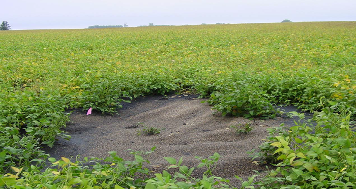
French Drain/Rock Inlet.
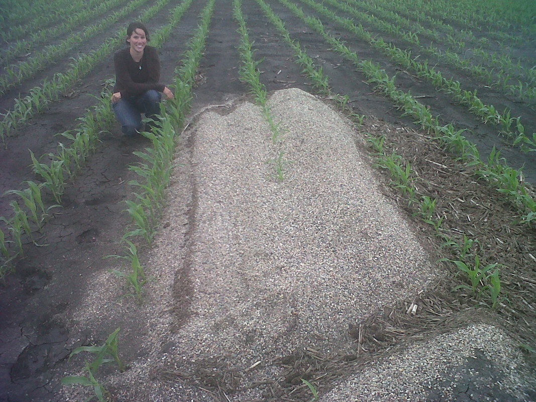
French Drain/Rock Inlet.
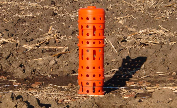
Hickenbottom tile intake.
Water quality inlet.
Water quality inlet.
|
wetland creation/restoration
|
From the Agricultural BMP Handbook for Minnesota, 2nd Edition:
Wetland Restoration Wetland Restoration re-establishes or repairs the hydrology, plant communities and soils of a former or degraded wetland that has been drained, farmed or otherwise modified since European settlement. The goal is to closely approximate the original wetland’s natural hydrologic regime and vegetation, resulting in multiple environmental benefits. Restoring wetland hydrology typically involves breaking drainage tile lines, building a dike or embankment to retain water and/or installing adjustable outlets to regulate water levels. Restored wetland plants usually include a mix of native water-loving grasses, sedges, rushes and forbs (broad-leaved flowering plants) in the basin or ponded area and a mix of native grasses and forbs in upland buffers around the basin. Water quality is enhanced in wetlands by the collection and filtration of sediment, nutrients, pesticides and bacteria in runoff or subsurface drainage. Downstream flooding may be reduced through storage of water, particularly frequent floods (less than 10-year frequency). Some wetlands may recharge groundwater supplies particularly in the fall and winter. Wetlands also help reduce soil erosion that would have occurred in bare farm fields by slowing overland flow and storing runoff water. Wetland plants utilize trapped nutrients while ponding restores soil organic matter levels and promotes carbon sequestration. Restored prairie pothole wetlands provide breeding grounds for ducks, geese and other migratory waterfowl whose habitat has been greatly reduced. Constructed Wetlands Constructed wetlands, sometimes called treatment wetlands, are man-made systems engineered to approximate the water-cleansing process of natural wetlands. In agriculture, constructed wetlands are used to filter runoff from cropland, feedlots, aquaculture operations and agricultural-processing facilities. Constructed wetlands can also provide habitat for some waterfowl, other birds, amphibians and invertebrates. |
Restored Wetland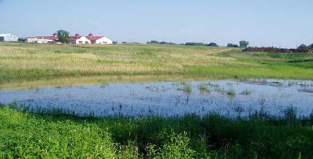
Constructed Wetland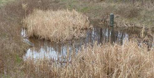
|
denitrifying bioreactor
|
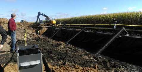
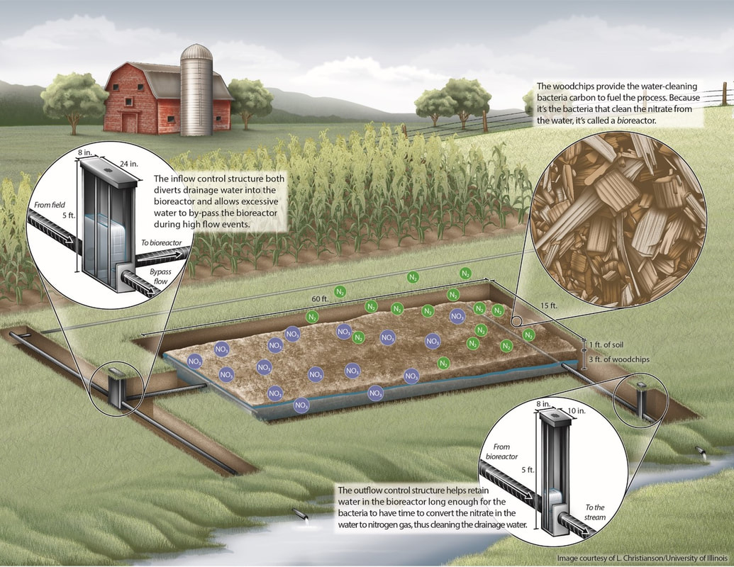
From the Agricultural BMP Handbook for Minnesota, 2nd Edition:
Bioreactors are practices that utilize a carbon source, commonly woodchips, to support the removal of nitrate-nitrogen from subsurface agricultural tile drainage. Woodchip bioreactors have been identified as one means of removing nitrate from subsurface drainage water. They remove nitrate by the process of denitrification. Under anaerobic conditions, bacteria use carbon from the woodchips in their conversion of nitrate to nitrogen (N) gas. Advantages of denitrification beds are relatively high rates of nitrate removal, small footprints, minimal maintenance during the design life, and low installation costs. The large majority of woodchip bioreactors used in agricultural subsurface drainage applications are the denitrification bed type. Typically a trench of 5- to 25-foot width and dozens of feet long is plumbed with an inlet and outlet manifold and filled with woodchips. Woodchip bioreactors have been shown to reduce average annual nitrate loadings in the range of 30 to 45% in field studies in Illinois and Iowa. On average across the Midwest, bioreactor nitrate removal is 37.5%. Nitrate removal rates are primarily governed by temperature, influent nitrate concentration, and hydraulic residence time. The percent load removal varies widely and can be 90+%. |
|
drainage water management
|
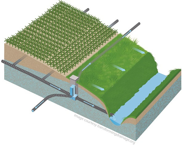
From the Agricultural BMP Handbook for Minnesota, 2nd Edition:
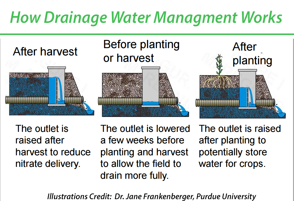
Drainage water management sometimes referred to as controlled drainage is a practice used to control or manipulate the ground water elevation in a tile drained field. Since the term drainage water management is increasingly being used for other practices and programs, the term controlled drainage will be used in this chapter. Controlled drainage is a practice where water is periodically held back within the root zone by adjusting the outlet elevation of the subsurface drainage system. The outlet elevation is typically adjusted using a drainage control structure, in which stacks of boards or stand pipes of different lengths are inserted to raise or lower the outlet elevation. Controlled drainage may be implemented as part of a new system or as part of a system retrofit, provided the layout of the existing system is conducive for controlled drainage. Water quality benefits attributed to controlled drainage result primarily from reductions in water yield volume. In other words, controlled drainage has little effect on nitrate concentration in tile drainage water so any reduction in loading is derived from a water volume reduction. A 2010 field study in Minnesota compared freely drained fields with those with controlled drainage. The study showed reductions in nitrate-nitrogen, total phosphorus (P), and ortho-P load losses of 61%, 50% and 63% respectively. |
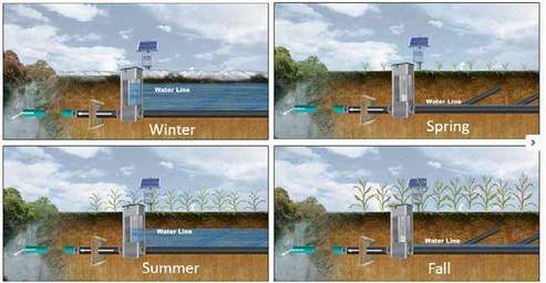
Controlled drainage allows producers to control the water by raising or lowering the outlet, making water available to crops when needed. This is effective at managing flow and reducing nitrate losses. (Image from Ecosystem Service Exchange)
|
Irrigation water management
|
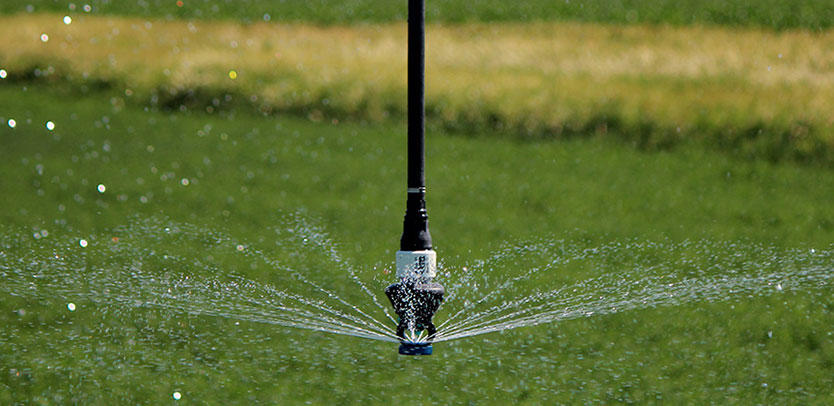
From the Agricultural BMP Handbook for Minnesota, 2nd Edition:
Irrigation management is controlling the rate, volume and timing of irrigation such that water is applied efficiently, minimizing the environmental impacts. Irrigation management can be applied to any irrigation operation. Irrigation management may have one or several objectives:
Irrigation rates in excess of the soil’s infiltration capacity lead to surface runoff. Surface runoff may contain soluble nutrients such as nitrate and pesticides. Additionally, surface runoff many cause erosion, transporting sediment and sediment-bound nutrients like P. Irrigated areas in Minnesota are typically defined as valleys that are composed of coarse outwash materials with low water holding capacity, high infiltration rates, and good internal drainage. As a result, on these soil types, supplemental irrigation is almost always required to profitably produce food, fuel and fiber crops. These outwash areas tend to be confined to the central and west-central part of the state; however, there are isolated pockets of irrigated, coarse textured soils in the eastern and southern part of Minnesota. If not managed properly, excessive leaching in sandy soils can lead to groundwater pollution with soluble nutrients like nitrogen (N) and pesticides. The traditional approach to irrigation management is to schedule irrigation using a moisture accounting method or checkbook method as described. The soil water content is depleted to its maximum allowable depletion (MAD) level, which triggers an irrigation event to bring the soil water content back to near field capacity, which is repeated until the crop reaches maturity. Additional inputs (rainfall) and withdrawals (e.g. evapotranspiration) are monitored to track the water balance. A more recent approach to managing irrigation water, is to integrate soil moisture sensors as a means to determine when to irrigate. Soil moisture sensors fall into two primary categories, soil water tension sensors and volumetric soil water sensors. Both can be used to determine depletion based irrigation triggers through the use of a soil moisture characteristic curve. |

|
rain garden
From the Minnesota Stormwater Manual:
Rain gardens, also called bioretention basins, are planted depressions that collect stormwater runoff from impervious surfaces, such as roofs and streets, and filter pollutants out of the runoff water.
How does a rain garden work?
Rain gardens have a relatively simple design. Native soil is dug up and replaced with a special engineered media that is designed to support plant growth but allow water to pass through quickly. This media consists mostly of sand but has organic matter (e.g. compost) and some clay. The sand allows water to pass through the media quickly, while the clay and organic matter hold enough water and nutrients to support plants. The organic matter and clay are also effective at adsorbing pollutants from the runoff water.
Water from an impervious surface is routed to the rain garden, where it ponds until the basin is full or runoff stops. Examples of how water is routed to a rain garden include a cut in a street curb to allow water to enter or direct discharge from a roof gutter. The ponded water soaks through the media and either percolates down into the underlying native soil, or is captured by the underdrain and returned to the storm sewer system. The ponded water must all drain within a day or two so that plants do not remain inundated with water and to create space for the next rain event.
Rain gardens should not be more than 1.5 feet deep, even when water drains quickly. This prevents plants from becoming totally submerged.
How effective are rain gardens?
Rain gardens that do not have an underdrain are very effective at capturing water and pollutants. All water captured by the rain garden and all pollutants in that water are removed from the storm sewer system.
What types of plants can be grown in a rain garden?
A variety of native perennials are best. Shrubs and trees are also encouraged but must be planted away from the point where water enters the rain garden. Plants located at the bottom of the rain garden should be water tolerant, while those located higher in the rain garden should be drought tolerant. This is one reason why perennials are the best option, since many are adapted to fluctuating soil moisture. For more information on plants, see this page.
What maintenance is needed for a rain garden?
Rain gardens need routine maintenance. The point where water enters the rain garden must be inspected roughly monthly to ensure that it is not clogged with soil or trash. Vegetation should be inspected roughly every two months to make sure it is healthy and to remove weeds. Trash and excess soil should be removed at this time. care must be taken to ensure that soils in the rain garden and vegetation are not trampled and compacted. Do not fertilize the vegetation.
What are the advantages and disadvantages of rain gardens?
Rain gardens are effective at treating stormwater. They are aesthetically pleasing and can help promote biodiversity (e.g. they attract butterflies, etc.). They are relatively simple to design and maintain and can be fit into many different urban settings.
Most rain gardens are relatively small since construction and maintenance of large rain gardens becomes difficult. Since they take up space, they cannot easily be used in highly urban settings, such as a downtown area. The first year of maintenance can be challenging as plants become established. Since rain gardens are typically small, they cannot treat large volumes of runoff.
More information
- Soak Up the Rain: Rain Gardens (U.S. EPA)
- What is a rain garden (Rain Garden Network)
- Rain Gardens (Capitol Region Watershed District)
- Raingardens (Blue Thumb)
Rain Garden at the Appleton City Office
SATURATED BUFFER
|
From the Agricultural BMP Handbook for Minnesota, 2nd Edition:
A saturated buffer is a practice where subsurface (tile) drainage water is diverted and spread into the subsoil beneath a vegetated riparian area via a diversion structure and perforated subsurface pipe. The water moves laterally through the subsoil toward a stream or ditch. The primary purpose is to reduce nitrate loading to surface water from subsurface drain outlets and slow the movement of water towards the stream. Saturated buffers are a relatively new BMP for treating agricultural subsurface drainage. Research is still guiding the design criteria; therefore, most of the information summarized below is based on the NRCS Practice Standard 604 with additional input from the developing researchers. Unlike filter strips (NRCS Standard #393), field borders (#386) or riparian vegetation cover (#390) which are designed to intercept surface runoff, saturated buffers treat subsurface drainage water by routing it through the subsoil of the riparian buffer. This creates saturated conditions and stores or slows the flow of the drainage water in the ground where nutrients can be removed within the buffer by plant uptake, microbial immobilization, or denitrification. The system should be designed to maximize the amount of subsurface drainage water distributed to the buffer subsoil. When the buffer reaches hydraulic capacity, the remaining flow must be diverted past the buffer to avoid impeding field drainage. |
Saturated buffers store water within the soil of field buffers, by diverting tile water into shallow laterals that raise the water table within the buffer and slow outflow.
|
FILTER STrIPS
|
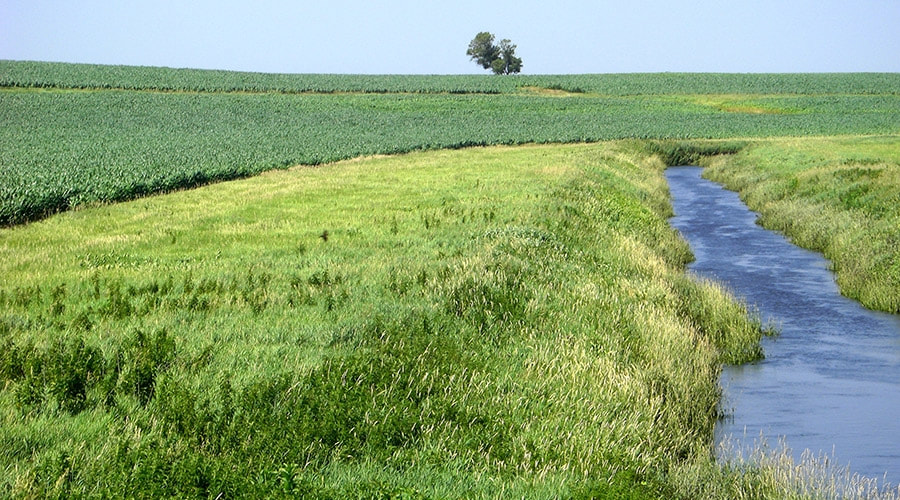
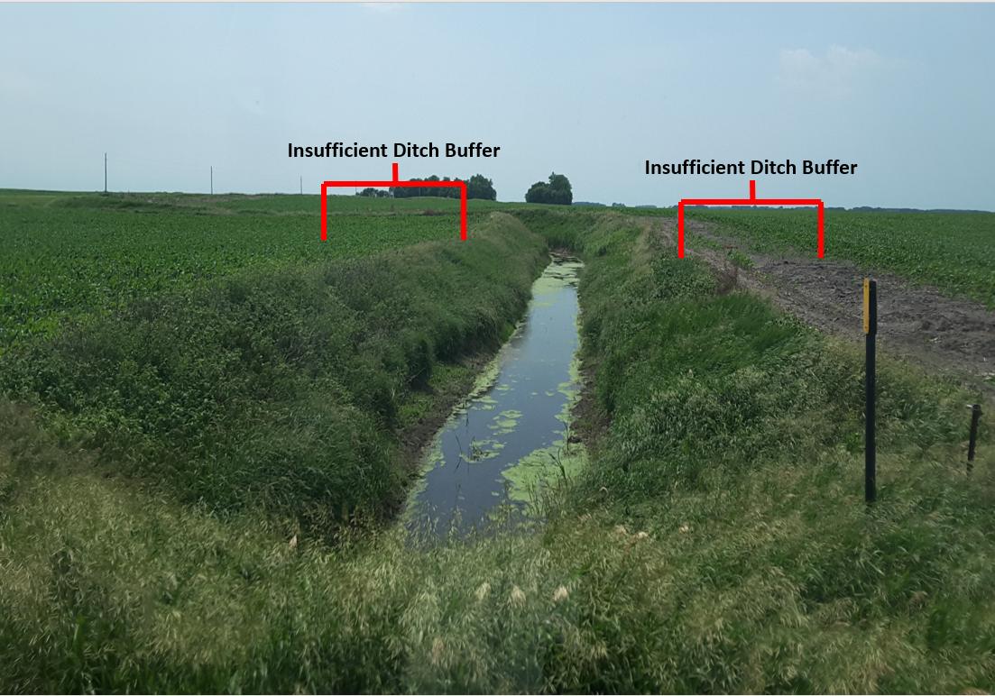
From the Agricultural BMP Handbook for Minnesota, 2nd Edition:
Filter strips are an area of vegetation planted between fields and surface waters to reduce sediment, organics, nutrients, pesticides, and other contaminants in runoff. Filter strips are one of the common BMPs used on farms state-wide and is considered by the NRCS as part of the “Core 4” practices that have conservation impact and can be implemented on almost every farm. Conservation buffers slow water runoff, trap sediment, and enhance infiltration within the buffer. Buffers also trap fertilizers, pesticides, pathogens, and heavy metals, and they help trap snow and cut down on blowing soil in areas with strong winds. In addition, they protect livestock and wildlife from harsh weather and buildings from wind damage. If properly installed and maintained, they have the capacity to:
They are a source of food, nesting cover, and shelter for many wildlife species. Buffers also provide connecting corridors that enable wildlife to move safely from one habitat area to another. Conservation buffers help stabilize a stream and reduce its water temperature. Buffers also offer a setback distance for agricultural chemical use from water sources. |
Vegetative buffer.
Buffer comparison.
|
streambank and shoreline protection
|
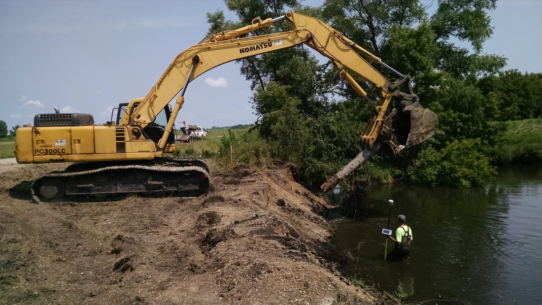
From the Agricultural BMP Handbook for Minnesota, 2nd Edition:
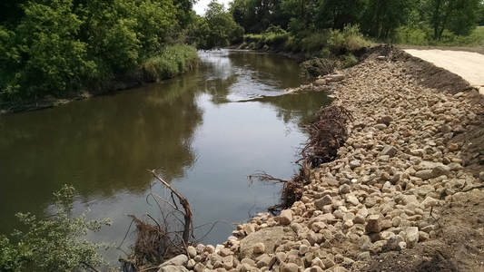
Streambank protection refers to both biological and structural methods of stabilizing streambanks and/or shorelines on rivers, streams, ditches, and other bodies of water. The goals of streambank and shoreline protection include preventing erosion or reducing rates to acceptable levels at key areas, maintaining adequate flow conveyance, or improving habitat, recreational opportunities and aesthetics. Streambank erosion can contribute substantially to sediment load in rivers, particularly in watersheds with high entrenched or unstable streambanks. Rivers with highly erodible soil materials are particularly prone to erosion as well as stream banks with low vegetation cover. The primary benefit of streambank stabilization is reduced erosion and phosphorus (P) loading. It is common to estimate the water quality benefit by estimating the volume voided over a period of time, calculating the mass of soil voided per year based on soil type (i.e., bulk density). This approach represents a reasonable approach for relatively short-term (~10 yrs) estimates of water quality benefit. After enough time, depending on individual site characteristics and hydrology, areas of erosion tend to self heal and stabilize. For streambank erosion control, grasses have been found to have the greatest benefit on small stream banks due to their dense root network. However, on larger, erodible streambanks, trees play a critical role during large flow events as they have larger diameter roots at depths greater than 12 inches. |
Streambank stabilization on the Pomme de Terre River, during. Installing root wads.
Streambank stabilization on the Pomme de Terre River, after. Image shows rip rap, erosion control blankets, root wads, stream barb and cedar revetments.
|
cover crops
|
Cover Crop Resources:
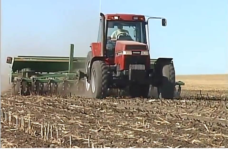
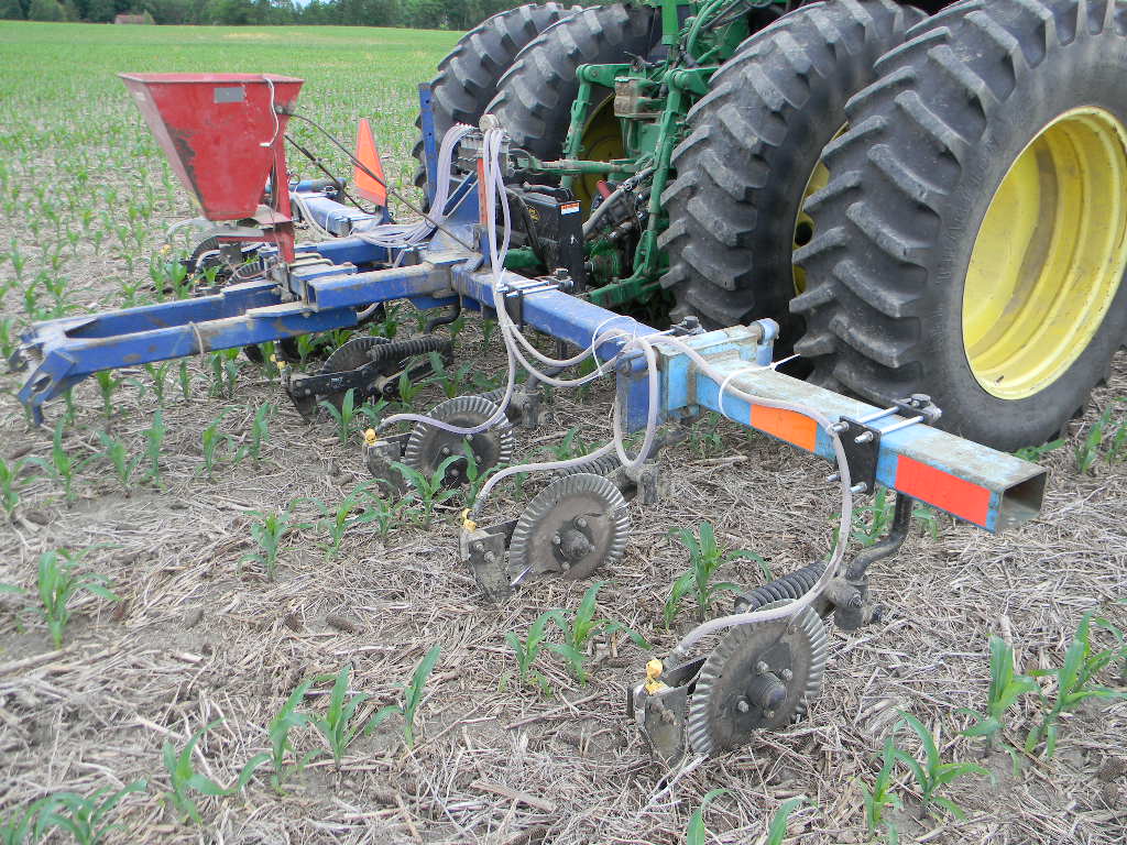
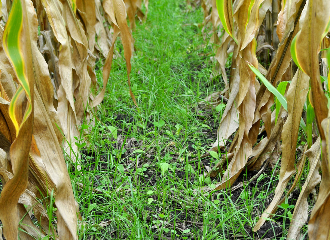
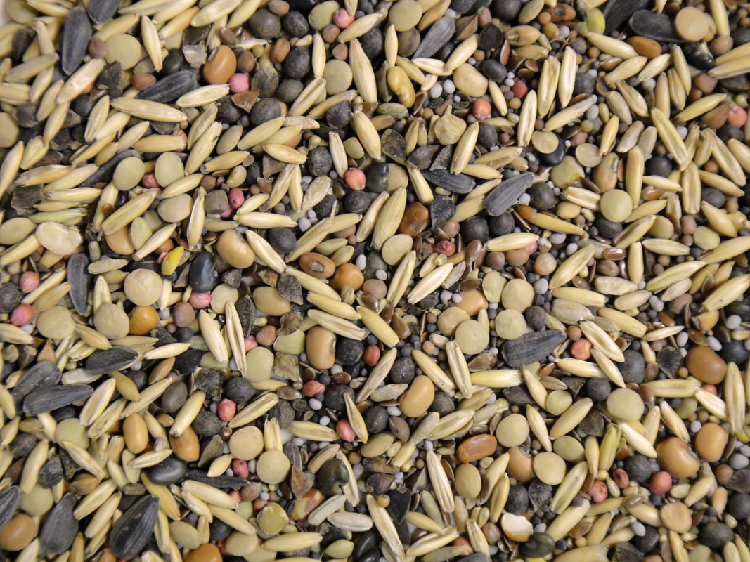
From the Agricultural BMP Handbook for Minnesota, 2nd Edition: Cover crops implemented as a BMP refers to the use of grasses, legumes, and forbs planted with annual cash crops to provide seasonal soil cover on cropland when the soil would otherwise be bare. In Minnesota, the cover crop is commonly winter rye, although oats, alfalfa, buckwheat, and other small grains are also used. The short growing season in Minnesota, paired with the use of full season corn and soybean, creates obstacles for adequately establishing cover crops although there is much evidence of cover crops’ potential for improving water quality; however, cover crop use is expanding as farmers see the environmental and financial benefits of the practice. From Managing Cover Crops Profitably: Benefits of Cover Crops Cover crops can boost your profits the first year you plant them. They can improve your bottom line even more over the years as their soil-improving effects accumulate. Other benefits reducing pollution, erosion and weed and insect pressure may be difficult to quantify or may not appear in your financial statements. Identifying these benefits, however, can help you make sound, long-term decisions for your whole farm. What follows are some important ways to evaluate the economic and ecological aspects of cover crops. These significant benefits (detailed below) vary by location and season, but at least two or three usually occur with any cover crop. Consult local farming groups and agencies with cover crop experience to figure more precise crop budgets.
From Considerations for Cover Crops and Preventive Plantings: In addition to the economic decisions about cost and return alternatives to late planting, prevented planting, failed planting, insurance payments, etc., you also should consider the following: how the field is managed through the summer – weed management, erosion protection, etc., whether you want the cover to winterkill or persist into the next growing season, seed availability, pre-applied nitrogen, susceptibility of these alternative cover or forage crops to carry-over herbicides, forage quality after November 1; whether the cover crop will be grazed or whether there will be a stored forage option (such as silage or hay), check with you crop insurance agent. |
Drilling cover crop seed.
Seeding cover crops at sidedressing.
Cover crop seeding into standing corn.
Cover crop seed mix.
|
Conservation tillage
|
Upper Midwest Tillage Guide -- U of M Extension
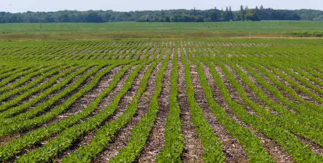
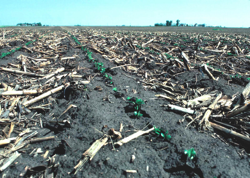
From the Agricultural BMP Handbook for Minnesota, 2nd Edition: Conservation tillage is any tillage practice that leaves additional residue on the soil surface for purposes of erosion control and moisture conservation. Conservation tillage is often defined as reducing inversion tillage (e.g., moldboard plow) and leaving at least 30% cover on the soil surface. Conservation tillage is one of the basic BMPs used on farms state-wide and is considered by the NRCS as one of the “Core 4” practices that have conservation impact and can be implemented on almost every farm. Many different variations of this common practice are implemented; which one is often based on climatic conditions and available equipment. Since 1994, the USDA has required the use of conservation measures on highly erodible land to remain eligible for program benefits. Conservation tillage is one of the easiest ways to protect erodible land with the least interruption of cropping practices. Crop residue is the most important factor effecting erosion from different tillage systems. The more residue on the land following tillage, the less erosion from the field. Ridge till, mulch till, strip till, and no till are all variations of conservation tillage. Ridge till is the practice of growing crops on pre-formed ridges alternated with furrows protected by crop residue. Mulch till refers to tillage methods used to manage the amount and distribution of crop residue in systems where the field is tilled prior to planting. No till and strip till involve planting directly into crop residue that either has not been tilled at all (no till) or has been tilled only in narrow strips (strip till). Water quality improvements are due primarily to improved erosion control but conservation tillage can also protect water from nutrient and pesticide losses. Conservation tillage can reduce soil loss up to 90% when compared to conventional tillage although chemical loss reductions are likely lower. Other benefits include: reduction in wind erosion, improve soil organic matter content, reduce CO2 losses from the soil, reduce soil particulate emissions, and also to provide food and escape cover for wildlife. The choice of tillage system on a farm is one of the most visible and complex choices that a farmer can make. In general, some form of conservation tillage is right for every farm in Minnesota and is the first defense against soil erosion. Soil type, crop type, slope and climate play a pivotal role in which method is the most effective and profitable. Conservation tillage is unique in that it is rarely a stand-alone BMP. Often nutrient management and pest management will need to be modified following conversion to conservation tillage. In general, conservation tillage is most effective on well drained soils and may cause delayed field access on poorly drained soils. |
Conservation tillage in a soybean field.
Strip till builds soil conditions, root strength and improves yield.
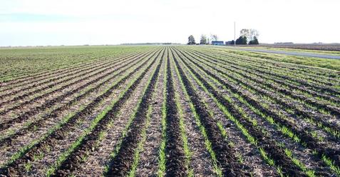
Ridge till soybeans in corn residue.
|